Switzerland has some of the best open forest data in the world — the National Forest Inventory, swisstopo imagery, 1-metre LiDAR canopy models, Sentinel-2. And almost nobody outside a GIS department can use it. Ask a simple question — how has our forest’s canopy or health changed? — and the honest answer has long been: wait weeks for a specialist, then squint at a result few non-experts can read.
For a Swiss forest-carbon project on a ~147-hectare municipal forest, that gap matters. Credible outcomes need measurement, not modelling — and measurement no one can interpret is worth very little.
Ask a question, get a map
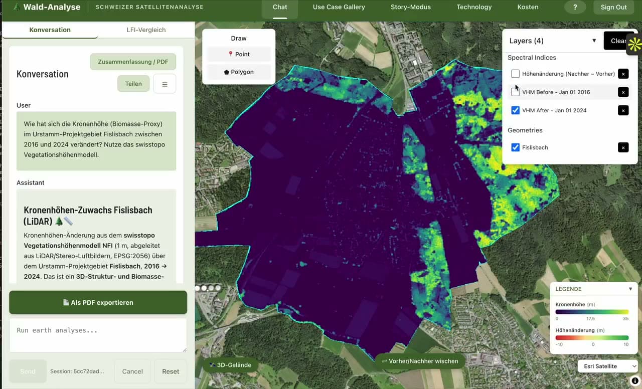
So we built Ask Your Forest: an AI agent that answers a natural-language question about any location by fetching and analysing the satellite and LiDAR data on demand — and returning a real, rendered map instead of a report.
Under the plain-language layer, the engine computes spectral analyses on the fly — NDVI for vegetation vitality, NDWI for water, NBR for burn and disturbance — and reads canopy-height change from the swisstopo 1 m LiDAR Vegetation Height Model as a biomass proxy. These are real measurements over the actual perimeter, not a generic estimate.
Why the 3D fly-over matters
Change on a spreadsheet convinces no one. Change draped over the mountain you know — before and after, with a legend and a source on every layer — convinces a town meeting. The fly-over runs in the browser with no login, so authorities and the public can see the same evidence the analysts do.
Every layer discloses its source, period and method: no black box, nothing you can’t trace back to open government data. That is the same principle — Jurisdictional Integrity — we bring to regulated AI: an answer you can stand behind, because you can see where it came from.
From forests to vineyards
The engine isn’t forest-specific. The same open-data pipeline now powers Vinea, generating satellite vineyard microsites for wine producers from the same NDVI, terroir and climate layers — proof that plain-language GeoAI generalises wherever there’s open Earth-observation data and a non-expert who needs an answer.
Open data is abundant. The scarce thing is a way to ask it a question. That’s what we built.